 Filter: Categories of Wisconsin Historical Images
Filter: Creator Name of Diedrich, Lawrence J.
Filter: Categories of Wisconsin Historical Images
Filter: Creator Name of Diedrich, Lawrence J.
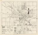
| Date: | 1961 |
|---|---|
| Description: | This map shows platted and proposed streets, streets to be widened, proposed pedestrian paths, lot and block numbers, city wards, public buildings, and par... |
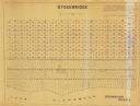
| Date: | 1955 |
|---|---|
| Description: | This map shows landownership in the old Stockbridge Indian reservation on Lake Winnebago in Calumet County. The lots are numbered and labeled by owner. A b... |
If you didn't find the material you searched for, our Library Reference Staff can help.
Call our reference desk at 608-264-6535 or email us at: